ASAL Humanitarian Network – Drought Impact Assessment
Mapping Drought Duration and Severity Across Kenya’s Arid and Semi-Arid Counties
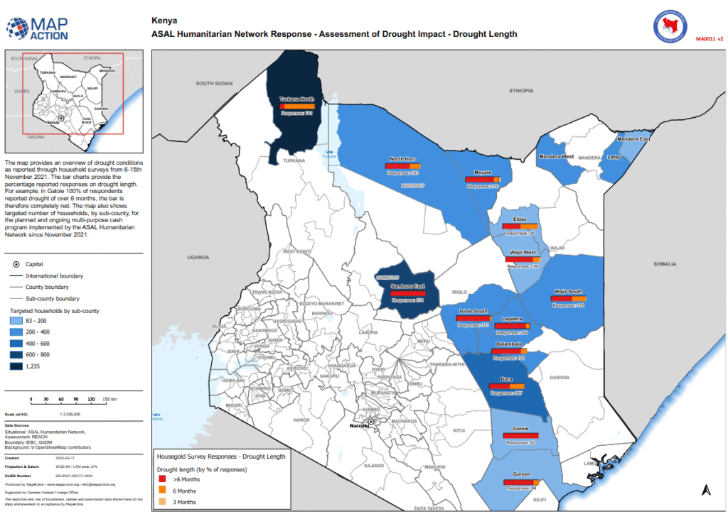
Drought Length Overview – February 2022
This map, produced by MapAction in collaboration with the ASAL Humanitarian Network (AHN) and REACH Initiative, provides a spatial overview of drought duration and severity across Kenya’s Arid and Semi-Arid Lands (ASALs) based on household surveys conducted between 6 and 15 November 2021.
Survey data show that in Galole Sub-County, 100% of respondents reported drought lasting more than six months, a pattern echoed across multiple counties experiencing four consecutive failed rain seasons. The results illustrate widespread climatic stress preceding the launch of AHN’s multi-purpose cash transfer (MPCT) response in November 2021.
The map overlays targeted household numbers per sub-county to connect drought conditions with humanitarian response coverage. It reflects early evidence used to guide AHN’s prioritization of cash-based interventions in the most affected regions.
Produced using administrative boundaries from IEBC and GADM, and supported by the German Federal Foreign Office (GFFO), this map serves as a key analytical layer within AHN’s drought impact monitoring system, informing ongoing response planning and early warning coordination.