ASAL Humanitarian Network – Drought Impact Assessment
Mapping Drought Duration and Crop Losses Across Kenya’s ASAL Counties
Agricultural Impact Assessment – February 2022
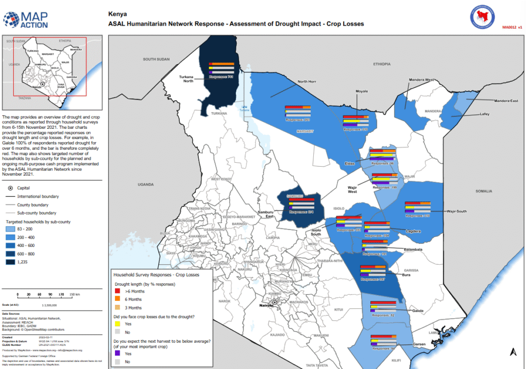
This analytical map, produced by MapAction in collaboration with the ASAL Humanitarian Network (AHN) and REACH Initiative, visualizes drought duration, crop loss, and harvest expectations across Kenya’s Arid and Semi-Arid Lands (ASALs). The data is derived from household surveys conducted between 6 and 15 November 2021, providing early evidence of the drought’s agricultural impact before the launch of AHN’s multi-purpose cash transfer (MPCT) response in November 2021.
Survey findings indicate that in Galole Sub-County, 100% of respondents reported drought lasting more than six months, while across other ASAL counties, a majority of households reported significant crop losses and expected below-average harvests for their primary crops. The map also shows the number of targeted households per sub-county, linking drought severity with humanitarian response coverage.
Developed with support from the German Federal Foreign Office (GFFO) and utilizing administrative boundaries from IEBC and GADM, this spatial analysis underscores the widespread agricultural stress caused by recurrent drought. The findings support evidence-based decision-making for food security planning, early warning systems, and localized recovery interventions in Kenya’s ASAL region.