ASAL Humanitarian Network – Drought Impact Assessment
Mapping Drought Duration, Rangeland Loss, and Livestock Condition Across Kenya’s ASALs
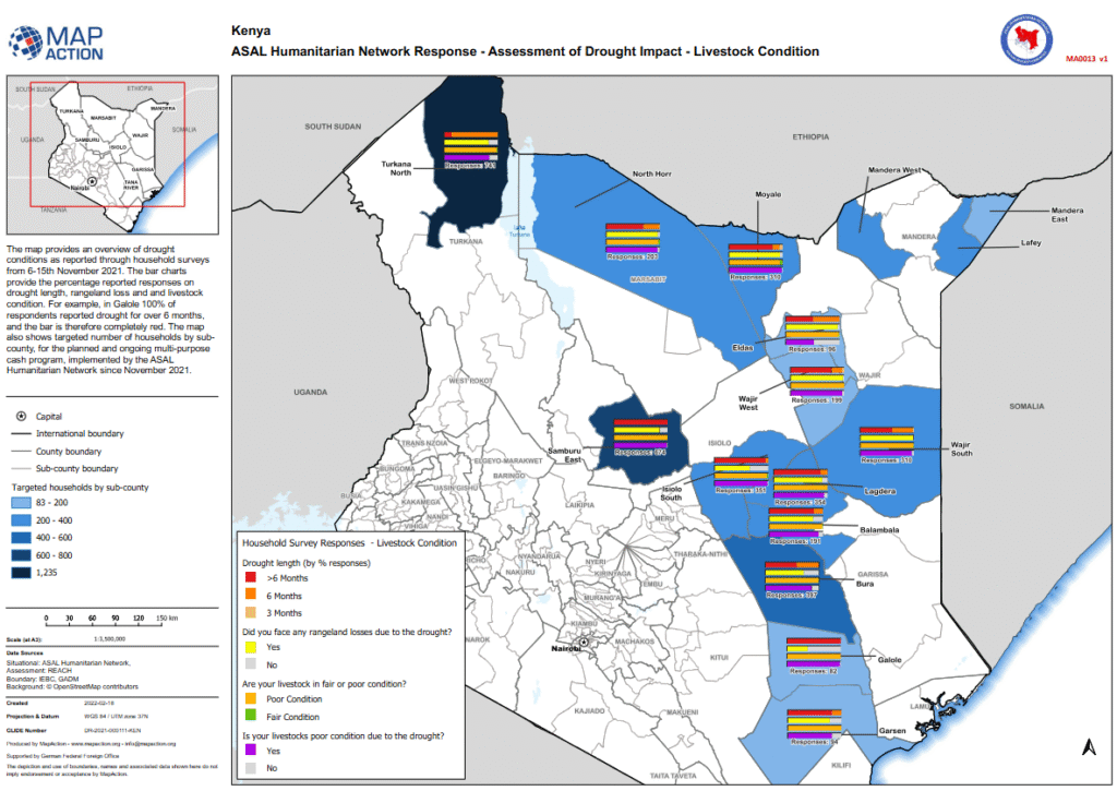
Agricultural Impact Assessment – February 2022
This analytical map, developed by MapAction in collaboration with the ASAL Humanitarian Network (AHN) and REACH Initiative, visualizes household survey data on drought duration, rangeland degradation, and livestock condition across Kenya’s Arid and Semi-Arid Lands (ASALs). The survey was conducted between 6 and 15 November 2021 to assess the early impacts of the prolonged drought on pastoral livelihoods.
Results indicate widespread and prolonged drought conditions: in Galole Sub-County, 100% of respondents reported drought lasting over six months, while most counties reported significant rangeland losses and deteriorating livestock health. The majority of surveyed households classified their animals as in fair or poor condition, primarily due to drought stress and lack of pasture.
The map also integrates data on the number of targeted households per sub-county under AHN’s multi-purpose cash transfer (MPCT) drought response initiated in November 2021, linking humanitarian assistance coverage to observed agricultural impacts.
Produced with support from the German Federal Foreign Office (GFFO) and using boundaries from IEBC and GADM, the analysis underscores the intersection between climate shocks and livelihood vulnerability in Kenya’s ASAL region, providing a spatial foundation for early action, livelihood recovery, and resilience planning.