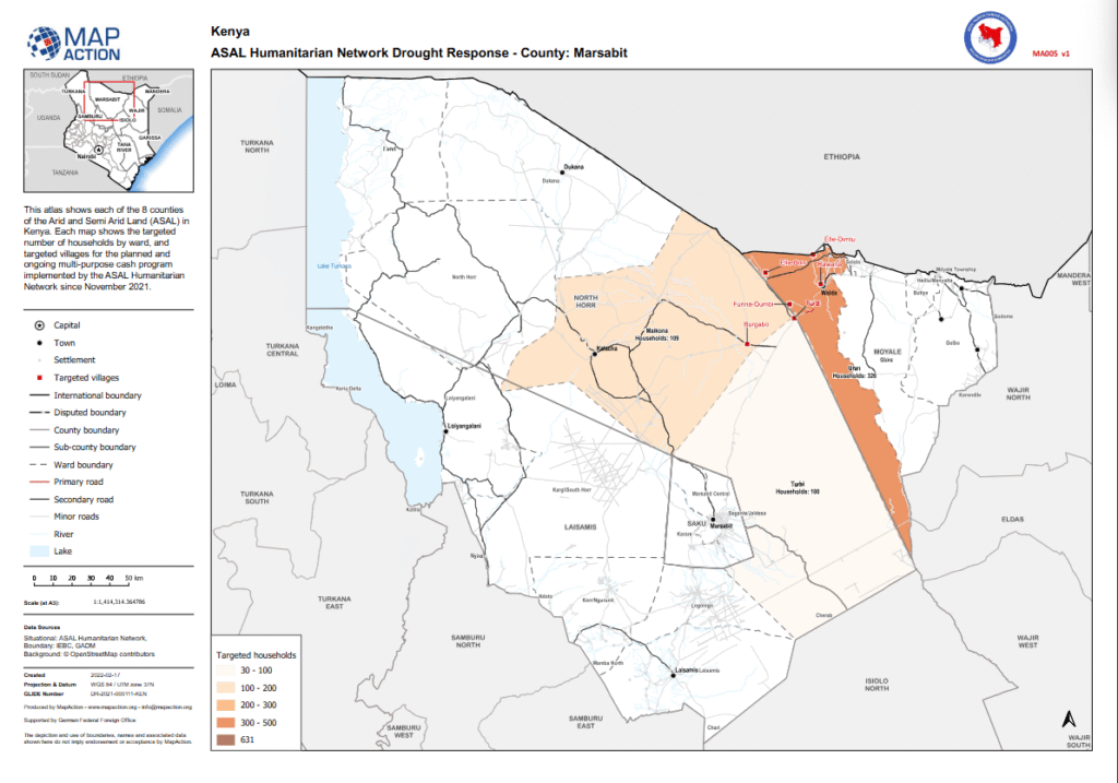
ASAL Humanitarian Network – County-Level Humanitarian Targeting
Mapping of Targeted Households and Villages for Cash Response in Marsabit County
Humanitarian Atlas – February 2022
This county-level humanitarian atlas, produced by MapAction in partnership with the ASAL Humanitarian Network (AHN), illustrates the geographic targeting of households and villages in Marsabit County under AHN’s multi-purpose cash transfer (MPCT) drought response initiated in November 2021.
The map visualizes the number of households targeted per ward, grouped into categories of 30–100, 100–200, 200–300, and 300–500 households, highlighting both planned and ongoing cash interventions. It also features key settlements, ward boundaries, and road networks to support operational coordination and planning among implementing agencies.
Developed using datasets from IEBC, GADM, and OpenStreetMap, and supported by the German Federal Foreign Office (GFFO), this atlas contributes to AHN’s commitment to transparent, evidence-based targeting across Kenya’s ASAL counties. It enables partners to better understand spatial coverage and ensure equitable reach of humanitarian cash programming in drought-affected areas.