ASAL Humanitarian Network – County-Level Humanitarian Targeting
Mapping Targeted Villages and Households for Cash Response in Tana River County
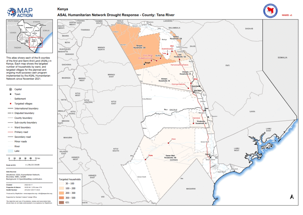
Humanitarian Atlas – February 2022
This county-level humanitarian atlas, produced by MapAction in collaboration with the ASAL Humanitarian Network (AHN), provides a geographic overview of targeted households and villages in Tana River County under AHN’s multi-purpose cash transfer (MPCT) drought response initiated in November 2021.
The map visualizes household targeting by ward across the county, categorized in ranges of 30–100, 100–200, 200–300, and 300–500 households, showing spatial coverage for planned and ongoing interventions. It highlights targeted settlements, primary and secondary roads, administrative boundaries, and rivers, providing a reference for operational coordination and equitable distribution.
Produced with support from the German Federal Foreign Office (GFFO), the atlas combines data from IEBC, GADM, and OpenStreetMap contributors. It serves as part of AHN’s broader geographic information system framework to strengthen transparency, coordination, and planning for humanitarian response across Kenya’s ASAL counties.