ASAL Humanitarian Network – County-Level Humanitarian Targeting
Mapping Targeted Households and Villages in Wajir County Drought Response
Humanitarian Atlas – February 2022
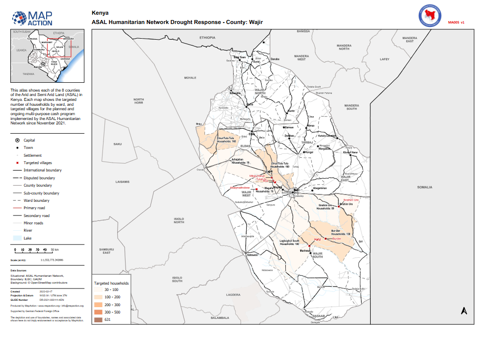
This county-level humanitarian atlas, produced by MapAction in collaboration with the ASAL Humanitarian Network (AHN), presents the geographic targeting of households and villages in Wajir County under AHN’s multi-purpose cash transfer (MPCT) drought response programme launched in November 2021.
The map illustrates the spatial distribution of targeted villages and the number of households reached per ward, supporting operational planning and partner coordination. Household targeting categories range from 30–100, 100–200, 200–300, to 300–500 households, with a total of 631 households mapped for Wajir County.
The data integrates IEBC and GADM boundary sources with open geospatial datasets and reflects planned and ongoing humanitarian cash response activities supported by the German Federal Foreign Office (GFFO). The atlas provides a visual reference for tracking coverage, assessing equity of response, and ensuring inclusive geographic targeting across Wajir’s drought-affected wards.