ASAL Humanitarian Network – Geographic Context Mapping
Mapping Kenya’s Arid and Semi-Arid Counties for Drought Response Coordination
Spatial Classification – Aridity Zones and Humanitarian Coverage
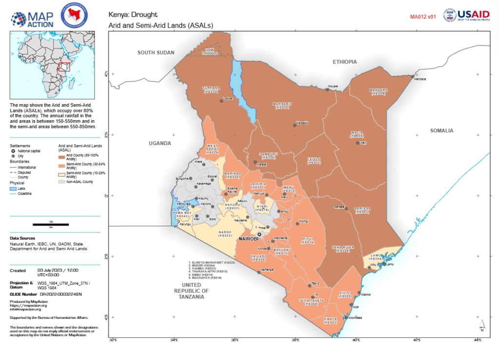
This map, developed by MapAction in collaboration with the ASAL Humanitarian Network (AHN) and supported by the Bureau for Humanitarian Assistance (BHA), delineates Kenya’s Arid and Semi-Arid Lands (ASALs) based on data from the State Department for ASALs. The ASALs cover over 80 percent of Kenya’s land area, characterized by low and variable rainfall ranging between 150–850mm annually.
Counties are classified by aridity levels: Arid (85–100%), Semi-Arid (30–84%), Semi-Arid (10–29%), and Non-ASAL zones. The map highlights the spatial extent of Kenya’s drylands across northern, eastern, and coastal regions, including Turkana, Marsabit, Mandera, Wajir, Garissa, Isiolo, Samburu, Tana River, and parts of Kajiado, Kitui, and Makueni.
The visualization provides a national reference framework for drought-related programming, enabling coordinated targeting and prioritization of humanitarian, resilience, and recovery efforts in the most climate-vulnerable counties.