ASAL Humanitarian Network – Drought Impact Assessment
Mapping Conflict Drivers Linked to Drought Conditions Across Kenya’s ASAL Counties
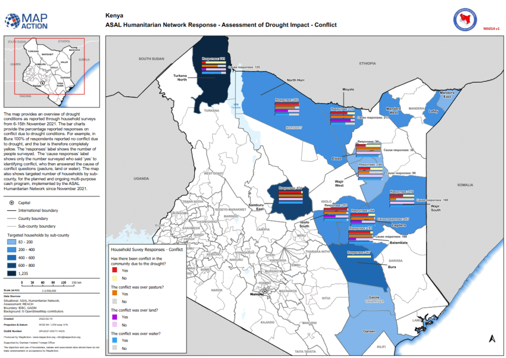
Conflict Assessment Map – February 2022
This analytical map, produced by MapAction in collaboration with the ASAL Humanitarian Network (AHN) and REACH Initiative, visualizes household survey responses on conflict related to drought impacts across Kenya’s Arid and Semi-Arid Lands (ASALs). The assessment, conducted between 6 and 15 November 2021, captures how communities perceived drought-induced conflict and its primary causes.
The data reveals that in several sub-counties, including Bura, 100% of respondents reported no conflict linked to drought, while in others, varying proportions cited disputes over pasture, land, and water as key triggers. The map integrates this perception data with the number of targeted households per sub-county under AHN’s multi-purpose cash transfer (MPCT) drought response launched in November 2021.
Conflict reporting patterns reflect localized pressures on natural resources amid consecutive failed rainfall seasons, underscoring the relationship between drought stress, livelihood competition, and community-level tensions. Developed using administrative boundaries from IEBC and GADM, and supported by the German Federal Foreign Office (GFFO), this visualization informs conflict-sensitive planning, targeting, and response coordination across Kenya’s ASAL humanitarian landscape.