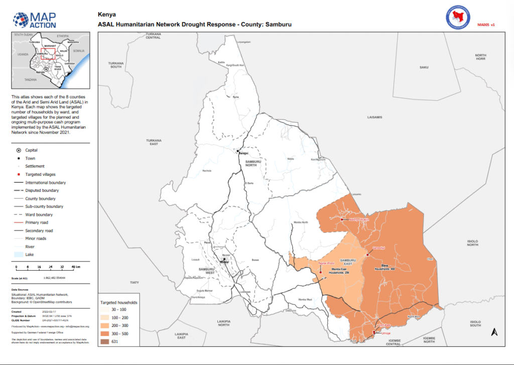
ASAL Humanitarian Network – County-Level Humanitarian Targeting
Geographic Mapping of Targeted Villages and Households in Samburu County
Humanitarian Atlas – February 2022
This map, developed by MapAction in partnership with the ASAL Humanitarian Network (AHN), visualizes the distribution of targeted households and villages in Samburu County under AHN’s multi-purpose cash transfer (MPCT) drought response launched in November 2021.
The atlas illustrates the spatial coverage of planned and ongoing cash assistance interventions, categorized by the number of households targeted per ward: 30–100, 100–200, 200–300, and 300–500 households. It includes the locations of key settlements, administrative boundaries, and road networks to facilitate coordination among implementing partners.
Developed using boundary data from IEBC and GADM, and basemaps from OpenStreetMap contributors, this map forms part of AHN’s broader GIS-supported humanitarian analysis framework. Produced with support from the German Federal Foreign Office (GFFO), it strengthens AHN’s capacity to ensure geographically balanced targeting, transparency, and evidence-based planning in Kenya’s ASAL drought response.