Mapping Ward-Level Household Targeting Across Kenya’s Drought-Affected ASAL Counties
Targeted Households by Ward – February 2022
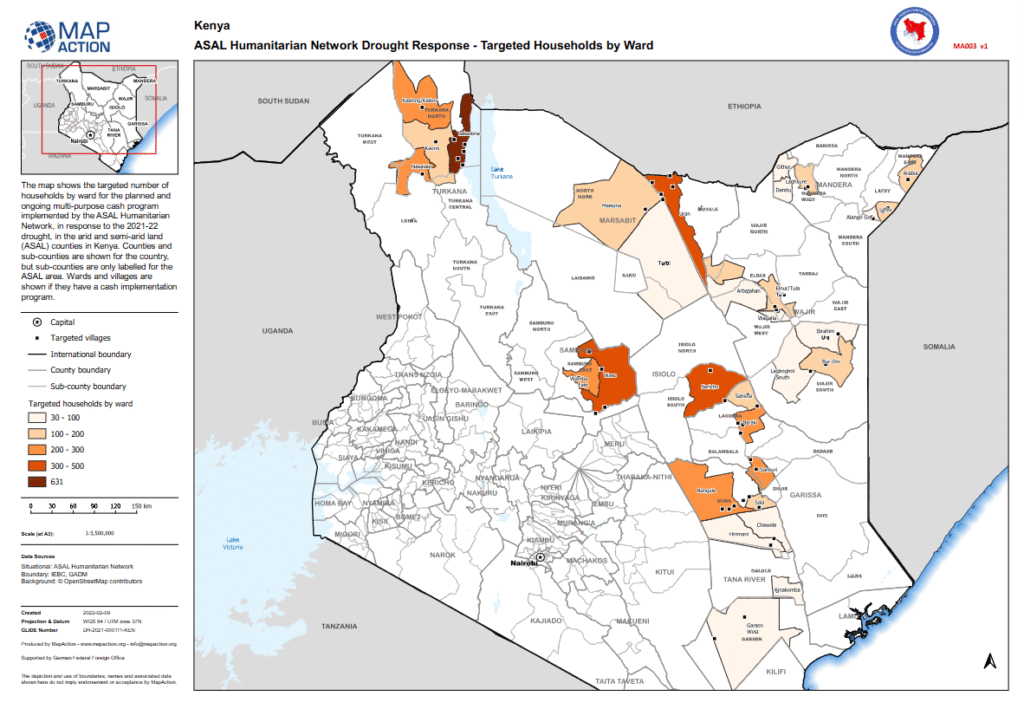
This map, produced by MapAction in collaboration with the ASAL Humanitarian Network (AHN), illustrates the number of households targeted per ward under AHN’s multi-purpose cash transfer (MPCT) drought response for 2021–2022. It provides a geographic overview of programme coverage across Kenya’s Arid and Semi-Arid Lands (ASALs), aligning humanitarian response with drought severity and population needs.
The map displays ward-level household targeting categories ranging from 30–100, 100–200, 200–300, to 300–500 households, identifying wards where cash assistance has been planned or implemented. Administrative boundaries include counties, sub-counties, and wards, with village points shown for areas where MPCT programming is active.
Developed using data from IEBC and GADM, and produced with support from the German Federal Foreign Office (GFFO), this visualization enhances coordination among partners by providing a unified 3W (“Who, What, Where”) picture of cash transfer activities. It contributes to AHN’s evidence-based humanitarian planning framework, promoting equity, transparency, and geographic balance in the national drought response.