ASAL Humanitarian Network – County-Level Humanitarian Targeting
Mapping Targeted Households and Villages in Isiolo County Drought Response
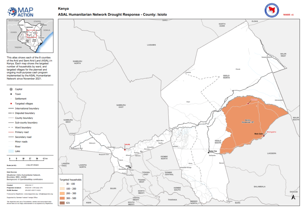
Humanitarian Atlas – February 2022
This county map, developed by MapAction in collaboration with the ASAL Humanitarian Network (AHN), presents the targeted household and village coverage for the multi-purpose cash transfer (MPCT) drought response programme implemented in Isiolo County beginning November 2021.
The atlas illustrates the number of targeted households per ward, grouped in ranges of 30–100, 100–200, 200–300, and 300–500 households. It overlays settlement data, road networks, and administrative boundaries to provide a geographic overview of AHN’s humanitarian footprint.
Produced with support from the German Federal Foreign Office (GFFO), and using data from IEBC, GADM, and OpenStreetMap, this map enhances transparency and coordination among partners delivering cash and livelihood support in Isiolo County. It contributes to AHN’s broader mapping initiative aimed at strengthening data-driven response planning and equitable resource targeting across Kenya’s drought-affected ASAL counties.