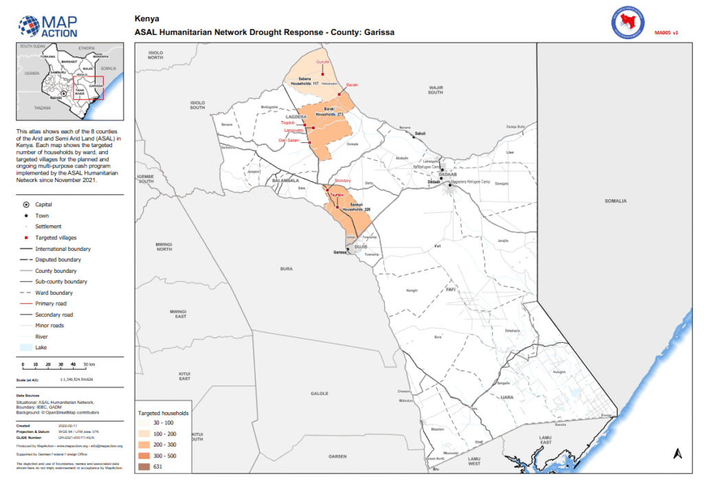
ASAL Humanitarian Network – County-Level Humanitarian Targeting
Mapping Targeted Households and Villages in Garissa County
Humanitarian Atlas – February 2022
This county-level map, produced by MapAction in collaboration with the ASAL Humanitarian Network (AHN), illustrates the geographic distribution of targeted households and villages in Garissa County under AHN’s multi-purpose cash transfer (MPCT) drought response launched in November 2021.
The map displays ward-level targeting, categorizing households in ranges of 30–100, 100–200, 200–300, and 300–500 households, and highlights priority villages such as Baraki, where 273 households were targeted for assistance. It also includes major settlements, rivers, and transport networks to enhance operational visibility and coordination among partners.
Developed using data from IEBC, GADM, and OpenStreetMap, and produced with support from the German Federal Foreign Office (GFFO), this map contributes to AHN’s broader GIS-based humanitarian planning framework. It supports transparency, accountability, and equity in the geographic distribution of cash-based interventions across Kenya’s ASAL counties.