ASAL Humanitarian Network – County-Level Humanitarian Targeting
Mapping Household Coverage and Targeted Villages in Mandera County
Humanitarian Atlas – February 2022
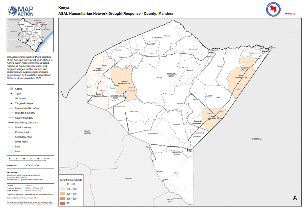
This map, developed by MapAction in partnership with the ASAL Humanitarian Network (AHN), visualizes the targeting of households and villages in Mandera County under AHN’s multi-purpose cash transfer (MPCT) drought response programme launched in November 2021.
The atlas displays the number of households targeted per ward, grouped into four categories (30–100, 100–200, 200–300, 300–500 households) and identifies the corresponding target villages. It includes settlements, administrative boundaries, and road networks, providing a geographic reference for humanitarian partners engaged in drought response.
Using data from IEBC, GADM, and OpenStreetMap, and produced with support from the German Federal Foreign Office (GFFO), the atlas enhances the visibility, transparency, and coordination of the cash assistance programme. It contributes to AHN’s broader GIS-based planning and accountability framework, ensuring that humanitarian support is delivered effectively and equitably across Kenya’s ASAL region.